


MONTOYA Voting District, Maricopa County, Arizona
About
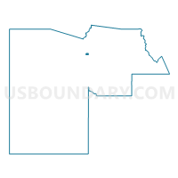
Outline

Summary
| Unique Area Identifier | 524686 |
| Name | MONTOYA Voting District |
| County | Maricopa County |
| State | Arizona |
| Area (square miles) | 2.01 |
| Land Area (square miles) | 2.01 |
| Water Area (square miles) | 0.00 |
| % of Land Area | 100.00 |
| % of Water Area | 0.00 |
| Latitude of the Internal Point | 33.70357680 |
| Longtitude of the Internal Point | -112.22000010 |
Maps


Graphs
Select a template below for downloading or customizing gragh for MONTOYA Voting District, Maricopa County, Arizona


Neighbors
Neighoring Voting District (by Name) Neighboring Voting District on the Map
- FLETCHER HEIGHTS Voting District, Maricopa County, AZ
- LAS BRISAS Voting District, Maricopa County, AZ
- LOS GATOS Voting District, Maricopa County, AZ
- MARIPOSA GRANDE Voting District, Maricopa County, AZ
- PYRAMID PEAK Voting District, Maricopa County, AZ
- TERRAMAR Voting District, Maricopa County, AZ
- THUNDERBIRD PARK Voting District, Maricopa County, AZ
- WEST WING Voting District, Maricopa County, AZ
- YEARLING Voting District, Maricopa County, AZ
Top 10 Neighboring County Subdivision (by Population) Neighboring County Subdivision on the Map
Top 10 Neighboring Place (by Population) Neighboring Place on the Map
Top 10 Neighboring Unified School District (by Population) Neighboring Unified School District on the Map
Top 10 Neighboring State Legislative District Lower Chamber (by Population) Neighboring State Legislative District Lower Chamber on the Map
Top 10 Neighboring State Legislative District Upper Chamber (by Population) Neighboring State Legislative District Upper Chamber on the Map
Top 10 Neighboring 111th Congressional District (by Population) Neighboring 111th Congressional District on the Map
Top 10 Neighboring Census Tract (by Population) Neighboring Census Tract on the Map
- Census Tract 6117, Maricopa County, AZ (6,304)
- Census Tract 6114, Maricopa County, AZ (6,232)
- Census Tract 6139, Maricopa County, AZ (6,154)
- Census Tract 6109, Maricopa County, AZ (6,027)
- Census Tract 6112, Maricopa County, AZ (5,911)
- Census Tract 6142, Maricopa County, AZ (4,891)
- Census Tract 6140, Maricopa County, AZ (4,398)
- Census Tract 6138, Maricopa County, AZ (4,075)
- Census Tract 6111, Maricopa County, AZ (3,270)